
United States Map With State Abbreviations
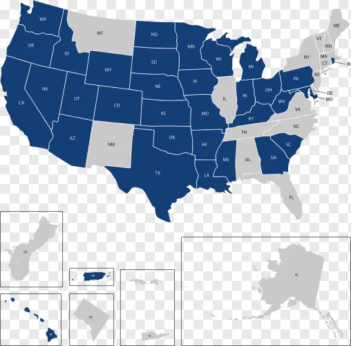
This detailed United States map clearly displays state boundaries and abbreviations across the country. It is an excellent resource for educational lessons, geography projects, and presentations.
Free download
No login required · 100% free · Instant access
Resolution1935 × 1905 px
FormatPNG · transparent
File size247.4 KB
File namepng-download-united-states-map-with-state-abbreviations.png
LicenceUser-submitted – see terms
This image was submitted by a user. PngDonut does not own it or grant a licence for it — the rights stay with the original creator. Read the Licence terms and get permission from the rights holder before any commercial use.
Similar PNGs
More cutouts you might pair with this one.